Albany’s Future – Unpacking the Concepts
I am posting a BIG blog about the ideas that are being considered for healing the damages to Albany created by the 787 highway system. I-787 is an interstate that never joined any states (!) and managed to physically disconnect Albany communities from each other and from our beautiful Hudson River.
My intent is not to disparage ideas that are in the works, but to use my experience to highlight the issues and learnings these concepts bring forth. It is not a small thing to vision a future-state for our City of Albany and commit to working toward it. We must exercise new thought patterns, seek new information, and open up our minds not just about how to make things better, but how to reach for the thriving potential of our future in the process. Every idea has some kernel of information that can inform our work and our ideas in projects over time. This extensive blog is intended to pull those truths out to be seen. I also want to draw out some of the serious challenges in the ideas we have growing in Albany. Again, not to destroy creativity or the movement, but to entice you to help fuel it with YOUR voices, your dreams, and your needs.
Every idea has some kernel of information that can inform our work and our ideas in projects over time. This extensive blog is intended to pull those truths out to be seen.
Universal concerns that are centered in every concept include: costs, the project time and process for deconstruction and construction, and a need to ensure any development of land released by this work is deeply informed by community organizations and voices. There will be disruption to downtown, South Albany, North Albany and the river as any significant work is done. Bridges will be impacted (as they would in all of these concepts).
The Canal Plan
This idea has been fueled by a beautiful painting from the 1980s of a Venice-like depiction of Broadway, in front of the SUNY building. The whole street and plaza in front of that lovely Belgian-inspired classic building is gone and replaced with water ostensibly from the Hudson River, docks, and lovely wooden boats. There is a nostalgia that is compelling, as is the feeling of vacation and leisure.
The image below is from the Waterway website.

Issues – I’ll share some problems that occur to me, first.
Although tourism can be a money-maker for a city or a government, and it can bolster some businesses – especially restaurants, bars, and cultural context – there is little in this concept for the residents of Albany, particularly those that have been undermined for years by redlining and by the damages of the highway system. Another issue is flooding Broadway or even portions thereof, on the river side or the City side of the building – this street and area is filled with infrastructure below grade including gas lines, electrical, switch gear, wastewater, and hydrant piping. It is also a massive undertaking to excavate close to existing buildings without destabilizing them, and then waterproofing those buildings below-grade adds another layer of complexity, cost, and risk.
The image is compelling, but boats mostly don’t look like that anymore and the leisure class doesn’t either. Furthermore, the image does not show our full communities.
This scenario (or scene, rather) also does nothing to address the highway itself, which is going to require significant investment even if we are to merely stabilize and maintain it. Logistically, the biggest issue (I have just been introduced to this) is that Broadway is fully 26 feet above the surface of the Hudson River: the water would never flow in naturally. This would necessitate locks on both ends of this “canal” and a pumping station to fill the trough. Even with sea level rise at the low-level prediction of 72 inches by 2100, the water of the Hudson will never fill a canal that is Broadway bound.
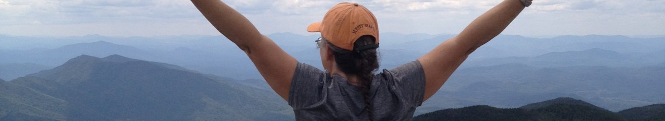
Learning – I believe this compelling depiction of a lovely downtown helps us to see that Albany can and should be beautiful, that we want people to walk around, access water, and find compelling outdoor spaces. Also, maybe there should be space for the Albany Yacht club to exist on the Albany side of the river. Can we provide not only yacht spaces but kayak storage and launches (more than one and please not under the shadow of a noisy highway) and room for people with smaller fishing boats, space for the economics of water taxis, and more water-moved freight? Maybe a place where people can bike to, or take public transit to, and then enjoy time in transit or for pleasure on the mighty Hudson. The photo below is of my husband kayaking near the Dunn Memorial Bridge on the Albany side of the river..
Albany can and should be beautiful, that we want people to walk around, access water, and find compelling outdoor spaces.

And with this there would still be room for restaurants and bars and pop-up shops, and leisure time. But maybe there is also room in every community-supportive vision for day care centers, community gardens, a local grocery, an active cultural venue on the river (Alive at Five is not enough!), and health services not just for sickness care but also for health care.
Small side note, there is a bit of a canal spur idea to celebrate the original lock-one, up-river and closer to the existing boat launch. This is much more water-level aligned, surprisingly, and it would also be a small spur, not needing any pumping or ways to hold water in. It would excavate the original lock and make a distinct and historic place in a useful river-adjacent park system, and could align well with planning for demolition of the Central Warehouse. This could be very cool, so long as it is an amenity that adds to what the communities seek, and not the only reason for the work.
The Tunnel, Cap, or Land-Bridges
This one has bothered me from the start and I want to be up-front about that. This seems to be a combo of the successful Boston Big Dig, Land Bridges for animals in the Netherlands, and maybe the amazing highway reformation in San Fransisco which included a highway-cap park.
Issues – Our work needs to be about reimagining and planning for Albany’s future. We are not Boston where we can fully bury the entire highway system. We are not the Netherlands, and this is a restricted bit of highway along a river, not a wildlife corridor that needs crossings as the river has always been there. And we are not San Fransisco where the city is positioned at a significant elevation above the highway. These approaches done in Albany will translate more into a tunnel, burying the highway between (approximately) the I-90 interchange to nearly the north entrance to the Port of Albany, or using several “caps” to fly over the highway to provide more expansive access to the river.
First, I find a lack of logic in adding more seriously expensive infrastructure to fix a failing massive-infrastructure system. We would also have to tunnel the train or cap the train, and putting a train that often carries liquid fossil fuels in a tube is problematic. Every added ton of concrete used in construction can release approximately a ton of greenhouse gas emissions just in material use, and then we need to add in the material burdens of the steel rebar and other structural elements, along with finishes inside the tunnel or under the caps. There would be a massive amount of construction above ground and above road after the deconstruction of the existing raised infrastructure.
Second, this does not improve access to Albany or to the river. A tunnel will likely not include exit tubes into Albany, restricting a lot of the car movement that we actually still want to have come into the city. Any cap approach, be it a full cap or intermittent land bridges, will actually restrict visual connections to the river further, and potentially restrict physical access for many people due the grades created by any flyover cap. Think of the pedestrian bridge at the bottom of Pine Street and make that a block wide. How does that impact the view, the existing buildings, and does it support freeing up any acreage for community-informed and community-led development? The renderings below come from the NYS DOT Reimagine 787 webpage.

Learning – The concern for pedestrian safety is significant, and our society has spent decades being taught that separating pedestrians from cars is always better. There is a big fear that putting the road at grade and providing more crossing points will create more danger. We need to do a lot of research, here, because, in many other cities, an activated increase in pedestrian, bicycling, scooters, and other alternative mobility has resulted in a significant reduction of accidents for all. The increased diverse mobility creates greater mutual awareness.
Check out this book to learn more about the evolution of the Dutch understanding of safety, people-first mobility design, and health.

…an activated increase in pedestrian, bicycling, scooters, and other alternative mobility has resulted in a significant reduction of accidents for all.
A system that reduces accidents, combined with societal health improvements (more walking, more beauty, more access), is a worthy goal for any plan. Unfortunately, the cap or tunnel approach seeks access only at designed points. Currently there are also only limited access points to the Hudson bank for people without vehicles. One from the warehouse district (at grade and convoluted), one at Pine Street (over the Walkway and with an elevator), one at the south end of Broadway (tight and dark at grade under the highway), and the new Skyway (up and over and zig-zaggy). It would be great if all streets provided better connections at grade, and by streets I mean streets for people who are walking, riding bikes, using whatever mobility device they need, and those who are using cars or public transit systems.
A Boulevard
Disclosure, this is where my heart is. The intent is to reduce the existing infrastructure, simplify the long-term maintenance burden, reduce noise, reduce vehicle speeds, reduce unhealthy particulate emissions, and provide more physical and visual access points to the river. The existing highway and interchange to the Empire State Plaza would come down to grade alongside about seven miles of Hudson River frontage. The Dunn would be a lower lift bridge and include multi-modal access.
Issues – The issues here are common to those in most of the shared concepts and include a lot of deconstruction, which would have to be managed with the communities. As a boulevard would reduce speeds, there is also concern that travel times from Colonie and the north into Albany would be unduly impacted, though the high-end of estimate of increase is 2-3 minutes. Some feel the slowing of cars and the increase in intersections mean Albany would have fewer visitors. Specific issues in this plan also include lots of freed-up space with a potential risk for longer-term vacant lots and vacancies is development slows.
There is also some concern about lift bridges creating traffic issues. The current Amtrak swing bridge opens for taller boat traffic about 400 times a year, averaging in the summer months maybe 4 times a day.
Learning – We need to address safety of all, and be realistic about commuter concerns while exploring the benefits of improved multi-modal access to our city and to the Hudson.
Below is a screen shot from a Congress of New Urbanism post, about another transformative bit of work in NY.

A more accessible City will grow visitor and local economic opportunities. Access includes a boulevard with slower traffic along with many more road access points into the city, providing less congestion at times of lots of traveling, such as rush hours, holiday and theatre performances, and events at the Arena. These intersections are depicted in the DOL plans as traffic lights, but I believe this is simply a notation to indicate intersection. We can employ well-designed (read simple) rotaries to keep vehicle traffic moving while allowing walkers and bicyclists to only have to cross one lane and one direction at a time, which is much safer.
As for commuters and other visitors, we want their experience into the City to be more engaging, not just zipping into a garage and then out at the end of the day, but maybe staying for dinner, shopping, or a walk along the river.
This amount of deconstruction gives us an opportunity for job creation (all approaches do) and to reuse the broken up concrete and steel creatively to implement resiliency approaches such as layered berms to extend sea level rise and flooding resilience along the Albany and Rensselaer sides and further down and upriver.
The bridges can include pedestrian and bike paths, and perhaps even tram lines or other linkages, and can be lower to bring people into the city and reduce people-power access limitations brought by capping and very high brigeways. We can designate any lift bridges as “local traffic” and post signage about planned opening times while directing through-travelers to I-90 or to I-87. As for commuters and other visitors, we want their experience into the City to be more engaging, not just zipping into a garage and then out at the end of the day, but maybe staying for dinner, shopping, or a walk along the river.
The Soccer Dream
This is a recent addition to considerations for Albany, with renderings depicting a new open-air soccer arena in the “parking lot district”. Please factor in as you read that I don’t find this to be a promising approach for Albany at any level.
Issues – Even when the highway interchange is reduced or brought to grade as many of us are hoping, this soccer arena would again create a wall between the business district and the South End. For images, you can check in with the instagram post I have linked.
The soccer arena creates a potential tourist attraction and yet does little for the residents of Albany. It will increase traffic during events and cause policing cost increases. It will offer a few jobs during construction and possibly in food services and janitorial, but nothing to support and sustain Albany residents with living wages and consistent hours, although some of the ideation includes living-wage residential development. This new venue will create tax revenue, yet the cost burdens of the stadium and the needed support from City budget and services may not justify the short-term win or feed long-term planning. This needs much more assessment and more engagement and inclusion of community in that assessment process.
Arena Ball and the River Rats have both left. We have only the Firewolves, using the MVP Arena, so we would be investing to support things we don’t currently have and have a poor history in. Environmentally, this would require massive parking used only during matches, and quite possibly even increase impervious surface area at a time when we need to let more water soak into the land as climate change hits us with bigger and bigger storms.
Learning – The cynical side of me feels we are attracted by shiny things and simple solutions. We want one thing or one approach to make Albany whole. When we are talking about our thriving future we need to celebrate the phases of the work, and incremental wins.
Albany’s biggest under appreciated natural resource is the Hudson River. I can’t help thinking that the key takeaway for us should be reliance on our healthy and vibrant river for attraction and activation of sports and outdoor play.
Reducing the highway and building access to the Hudson will entail decades of ongoing work and a focus on all of the communities of the city. This can feel overwhelming. We can be clear about the exciting nodal impacts that really are the shiny bits. From this concept we also learn of our excitement as a community about sports and attracting people to Albany. Albany’s biggest under appreciated natural resource is the Hudson River. I can’t help thinking that the key takeaway for us from this concept should be reliance on our healthy and vibrant river for that attraction and activation of sport.
Summary –
In summary, although the public comment period for NYS DOL DRAFT PEL (Planning and Environmental Linkages) documents closed on December 1, 2024, the documents are still there for your review, and there will be future phases for inputs and a final set of documents early in 2025.
I also highly encourage you to check out the ARC website, where you can use slider bars to see some of the ideas we have been using to learn about our communities’ needs. Play with those slider bars, share your concerns with ARC and the Reimagine Albany coalition, which includes many long-serving and valued community benefit organizations. And follow us on LinkedIn and Facebook! Every insight into what Albany can and should be is vital to creating a vibrant future for ALL of us. Take a look at the future of YOUR city and impacting YOUR community. Weigh-in and share your concerns and your needs and your desires!
The next big push will be finding federal and state investments for an EIS (Environmental Impact Study) to assess costs and concerns around a few selected proposals. Please also recognize that he future of Albany and the Hudson River is not contingent on one project, but is an unfolding long-term set of improvement touches of many scales. Take part when you can to help our city evolve over the next few decades into a city for our people and in reciprocity with our historic and inspiring river and valley.
Here’s to our future!
Jodi